To meet our research aims we use a range of field methods and laboratory analyses from low to high tech. Here you can read more about the different techniques we use in our research.
Survey
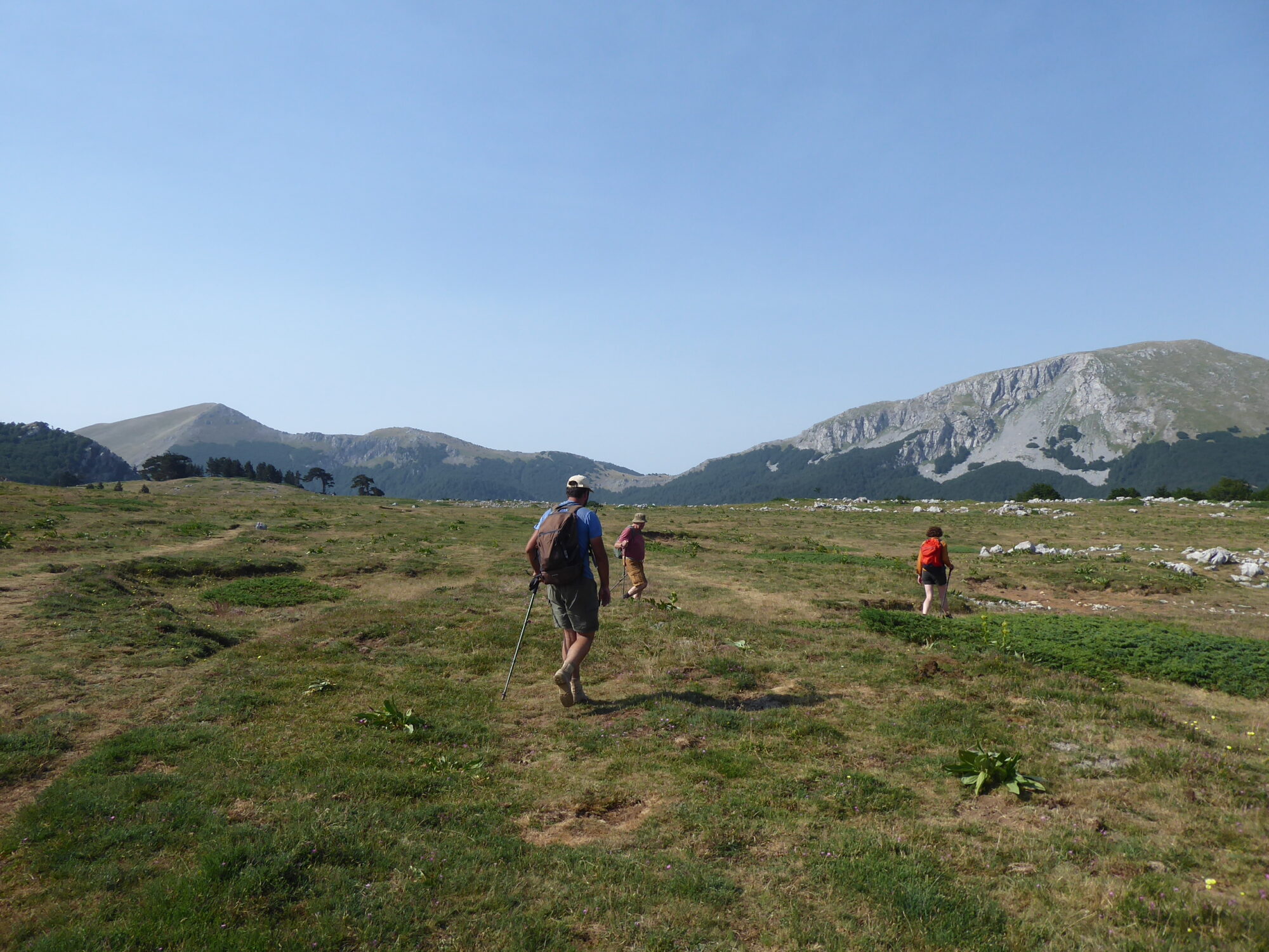
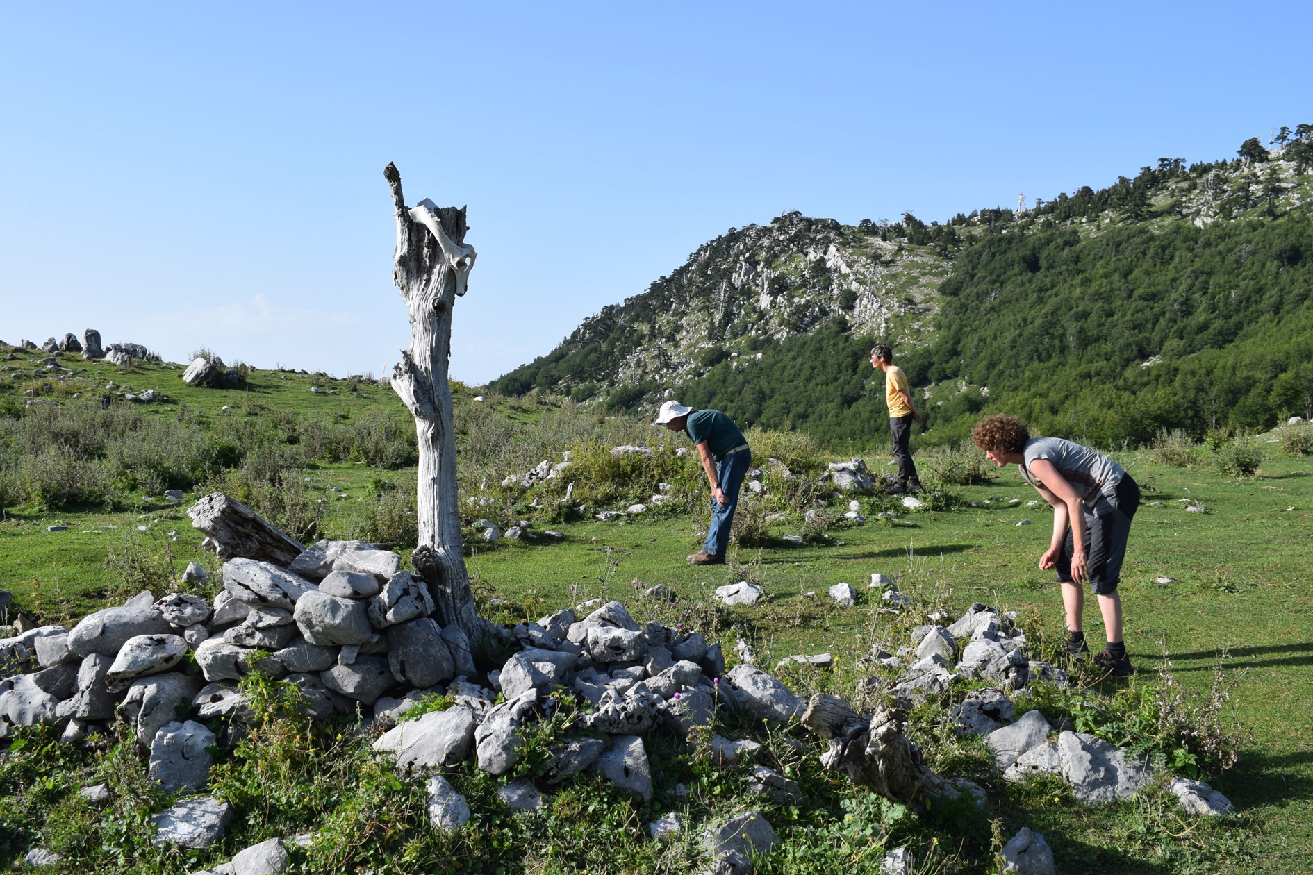
Our eyes are our main tool. Since 2020 we have conducted many surveys of the paths, valleys, plains and forests of the Pollino mountain range. In an archaeological survey we look for visible signs of human activity. This can be a piece of ancient pottery or flint, but also the 20th c. CE dry stone remains of long forgotten buildings. We collect finds and record structures taking precise location points using GPS. This results in a map with all our findings. By studying both the locations on the map and the recorded artefacts, we can detect patterns which tell us about the people that left these traces and how they used the landscapes of the Pollino.
Geophysics
In the field we also make use of geophysical instruments. These are tools which allow us to take a look at what lies under the surface without removing the soil. In the Pollino we used two different methods: ground penetrating radar (GPR) and magnetometry. A GPR sends out high-frequency radar pulses and then registers the time it takes the pulses to bounce back on whatever lies underneath the surface. This way the GPR can detect objects or changes in the material in the ground. A magnetometer measures local variations in the Earth’s magnetic field. Since different objects or soil types have different magnetic properties, we can record local changes in soil materials near the surface. This way we can detect walls, ditches, fireplaces, and refuse pits.
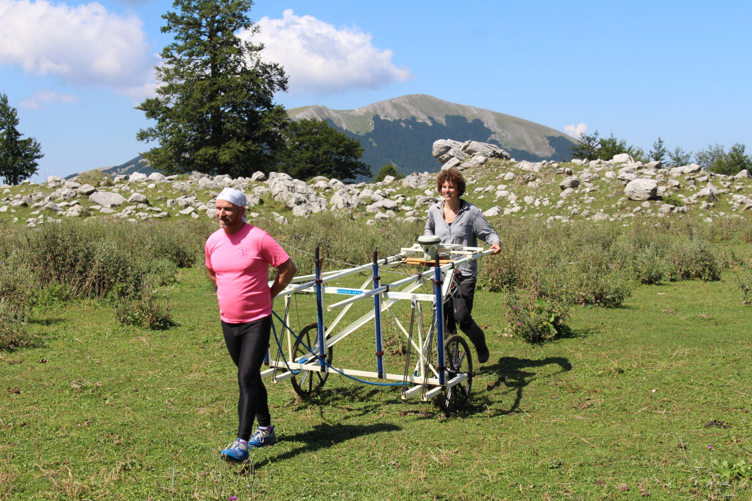
Coring
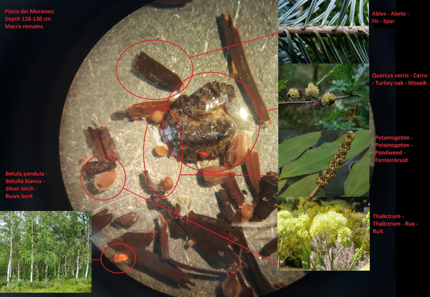
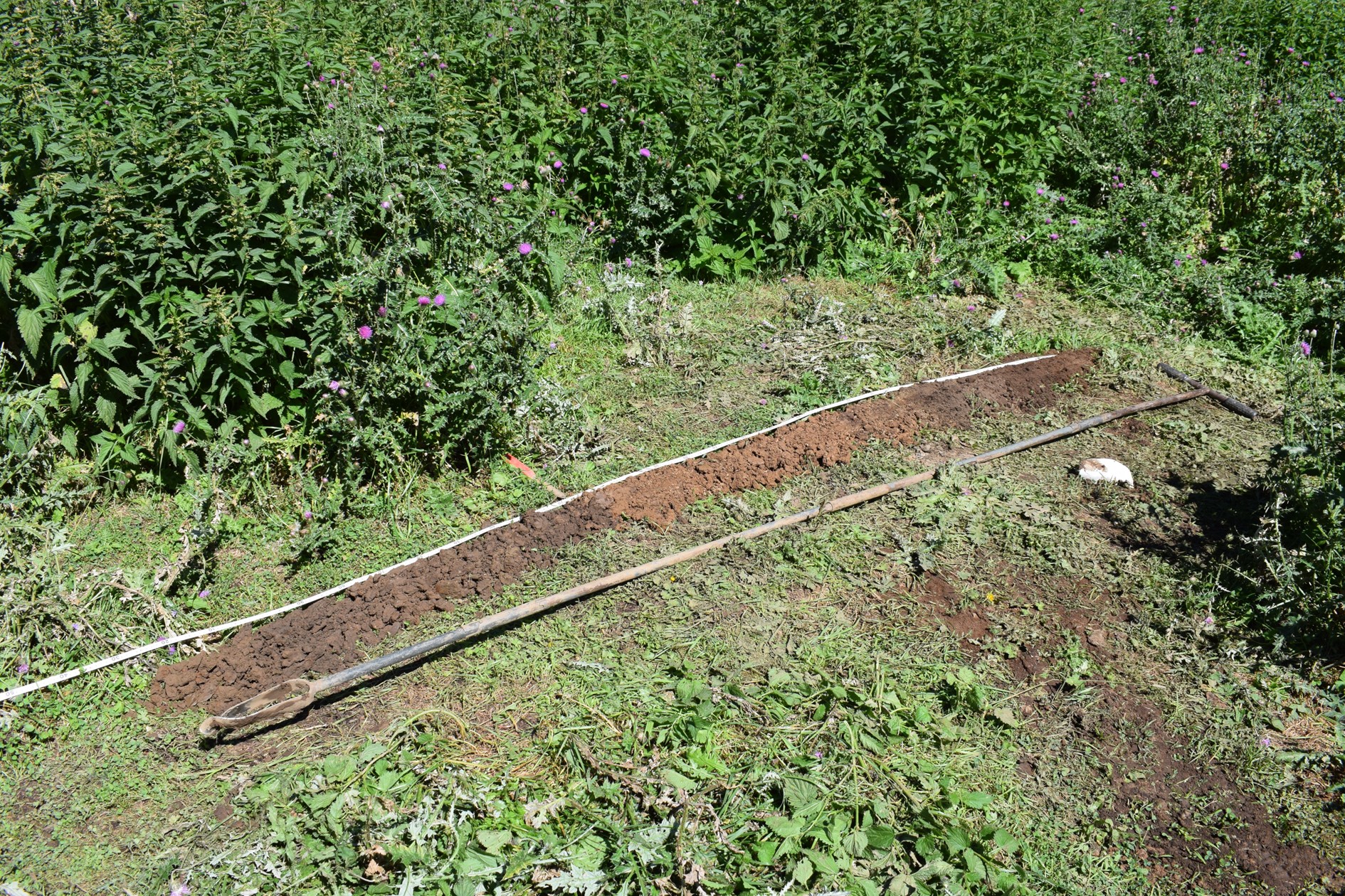
Climate change and human impact cause erosion and sedimentation. By coring in places where sediment accumulates, we obtain data for the reconstruction of the changing environment of the Pollino landscape. We use a handheld auger to collect series of soil samples in sequences of 25 cm, sometimes reaching depths of several meters. The photo shows a sequence of such soil cores from the Piano dei Moranesi containing botanical remains (pollen, seeds, charcoal, spores of funghi) and volcanic ash layers. This particular sequence covers the Middle Bronze Age to the Roman period and provides important evidence for variations in vegetation cover caused by climate changes, natural disasters, and human impact. Chronological control is provided by radiocarbon dating and analyzing tephra layers. This particular coring featured ashes of the 79 BCE Vesuvius eruption which destroyed Pompeii.
Organic materials are examined in the archaeobotanical laboratory at the University of Groningen resulting in the identification of plant and tree macro-remains and pollen. These allow to reconstruct vegetation cover through time. The coring provides evidence for increasing human impact on the Pollino highlands at least from the Bronze age onwards.
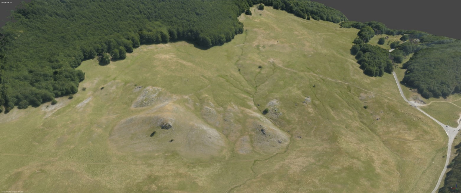
Drone imagery
We use a drone to map our survey areas and obtain views that are usually only reserved for the Griffon vulture. It helps us to get a clearer idea of how to interpret the remains of structures from a landscape perspective, which can often be quite difficult from the ground. Mapping our research area also allows us to use this image as a reference for the results obtained by our geophysical research. By overlaying the geophysical map with the drone image, we can better understand how to interpret the geophysical data.
Photogrammetry
Photogrammetry is a method of visualizing photographs in order to create 3D-models of the objects we are studying. This is done by taking hundreds of photos of an object or structure, taken from different angles. These photos are then combined using a special software to create a 3D-model. These photos can be taken with a drone or normal camera. By creating these models, we can continue to study these structures, even after the campaign has ended. The model shows the remains of a subrecent dry stone pastoral dwelling, located at the Mandra dei Montoni. The site was investigated by the team in 2022.
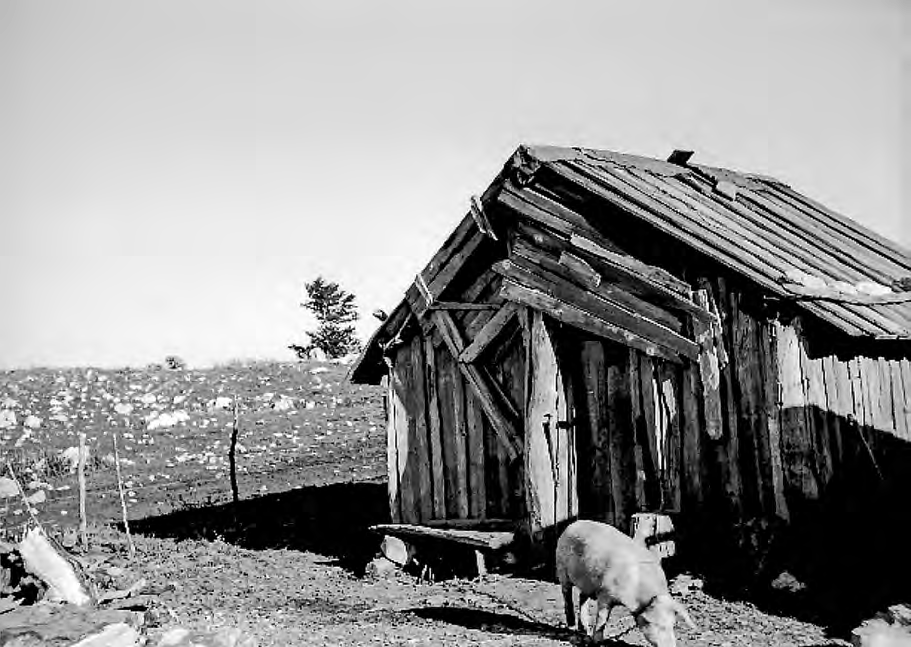
Historical records
Old photos can provide valuable insight into life on the Pollino. An example of this can be seen here. It shows a wooden structure of which most traces by now would have disappeared. Images like this are very important to the project, but very difficult to find.
Do you have old images or films of life on the Pollino, or know someone that does? Please contact us via antoniolarocca1965@gmail.com!
Interviews
While the Pollino has been used for hunting and pastoral activities for thousands of years, the area is now above all dedicated to ecotourism. The structures and artefacts from the past we study can tell us many things, but there is also a lot that they cannot reveal to us. Therefore, it is important that we speak to people that used to sojourn here when they were young. Speaking with these people is invaluable for our understanding of life in the Pollino in the recent past and by extension in a remoter past.
Have you lived on the Pollino, or do you know someone who did? Please contact us!
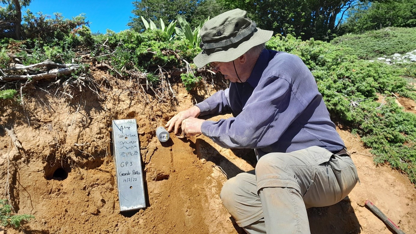
Soil studies
The soils of the Pollino help us to understand how the landscape changed over time. Soils are archives that hold information on vegetation and climate, for instance in the soil cores we collected at the Piano dei Moranesi. They can also inform us on local circumstances that affected the deposition of soil material, like erosion or water transport. For instance: in dry, cold periods such as Ice Ages, there are only few plants that survive in mountain zones. Fine sand particles can easily blow away under such circumstances, and can travel long distances. In the Pollino we find pockets of such old fine sand deposits, landed when Neanderthals and early Homo Sapiens roamed the mountains. Similar effects today are the Sahara sands that regularly arrive in the Pollino with southern winds.
We can date old soil deposits in different ways. The first is by looking at archaeological artefacts trapped in them, which we can compare with other sites with similar finds. Pottery gives good dating clues, although prehistoric pottery made under low temperatures breaks easily and therefore does not conserve very well. The stone artefacts of the early hunter-gatherers in the Pollino are also dating tools. By looking at the technologies used to produce stone tools, we can tell when they were made. This way we are able, for instance, to distinguish Neanderthal presence (Middle Palaeolithic) from early Homo Sapiens (Late Palaeolithic).
We can also obtain more accurate chronologies from soil samples. A well-known technology is radiocarbon dating. However, for very old soils we have to use another technique: optically stimulated luminescence (OSL). The University of Innsbruck dated soil samples from an erosion gully near Grande Porta di Pollino. The results confirm that the fine sands here were deposited during the Middle and Late Palaeolithic, before and after the last glaciation of the Pollino mountains.